
| SERVICES
What We Do?
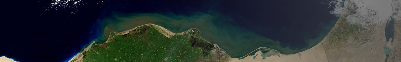
Aerial Mapping – Photogrammetry
Aerial mapping/photogrammetry is the basis of any engineering, infrastructural and planning work.
Aerial mapping enables to analyze and decipher the topography of large and complex areas with great precision and detail to provide as much information as possible of the conditions of land, heights, obstacles, greenery and structures, and allow engineers and infrastructure professionals to plan with laser precision without needing to measure in the field.
The mapping process, in which a bundle of hundreds of aerial photos is turned into digital vector data, is complicated. Trig Company, as a technological leader, uses the most advanced tools this world has to offer and only the best professionals in Israel to perform the mapping work, while meticulously maintaining quality assurance according to ISO standards and the measurement regulations and also guiding the client throughout the project.
These advantages provide the company’s clients with the maximum efficient planning/performance work, budgetary savings and durable management of spatial information databases.
Camera used for photography is PHASE ONE, which is approved by the Mapping Center of Israel and is suited with a 50mm focus length. Considered one of the best aerial photography cameras in the world, the camera provides a resolution of 5cm/pixel and maximum scale of 1:500.
Trig, one of the oldest and most experienced companies in the photogrammetry industry, has performed hundreds of projects, and has consulted in various diverse projects, both locally and worldwide.
Work process:
- Order placement
- Task analysis by a qualified measurer and photogrammetrist
- Flight planning
- Flight
- Flight output processing
- Field measuring of control points
- Solving aerotriangulation
- Deciphering Analytic Stereo
- Quality assurance
- Editing products according to the Unified Plan Structure format.
- Quality assurance
- Submission