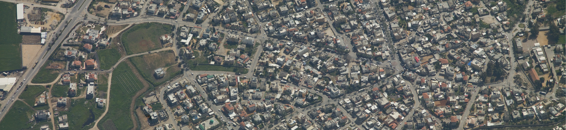
Aerial Photography
Aerial photographs are the basis of aerial mapping, orthophotography and 3D modeling, which are used to generate topographic information layers used for a wide variety of engineering fields.
Aerial photography is done using advanced technological tools to observe tiny elements from a bird’s eye view, analyze them, and add accurate and updated information of the surface area.
The aerial photography process mandates unwavering photo quality standards. As a result, the photography crew and devices are top tier:
- Camera used for photography is PHASE ONE, which is approved by the Mapping Center of Israel and is suited with a 50mm focus length. Considered one of the best aerial photography cameras in the world, the camera provides a resolution of 5cm/pixel and maximum scale of 1:500.
- Flight planning is done using the leading senior German software, AEOROTOPOL by KEMPER.
- The flight equipment includes GPS and a Gyro stabilizer by KEMPER Germany.
- An experienced crew with hundreds of hours of experience in aerial photography.
Trig has a variety of solutions for shooting relatively small areas using quadcopters.
Such advantages provide Trig’s clients with high photograph quality for a myriad of purposes and uses.